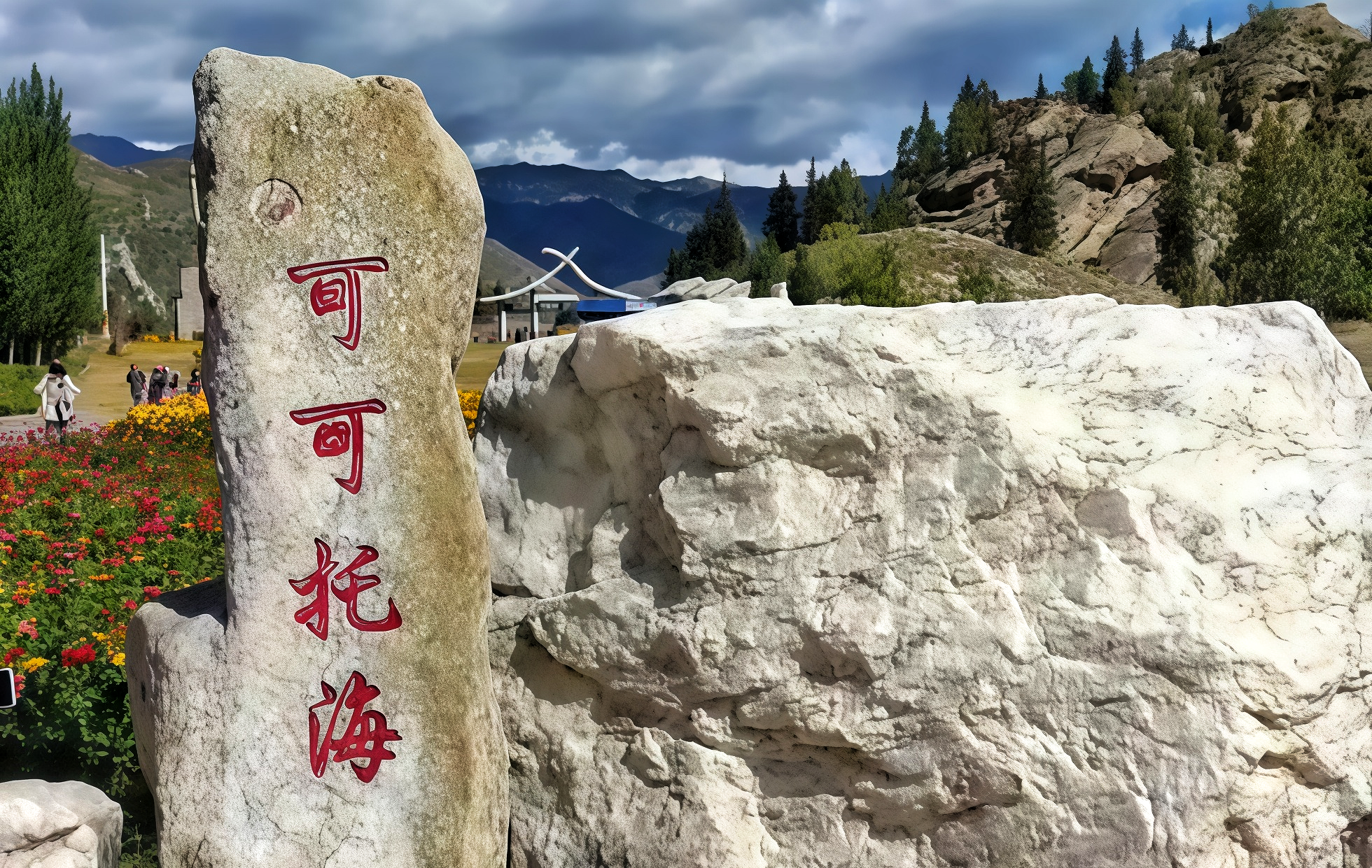
Nature's Masterpiece: An Epic of Granite and the Symphony of the Irtysh
The natural landscape of Koktokay is an eternal dance of water, stone, and color.
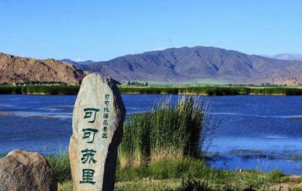
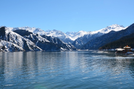
The Dynamic Waters: China’s Only River Flowing into the Arctic Ocean
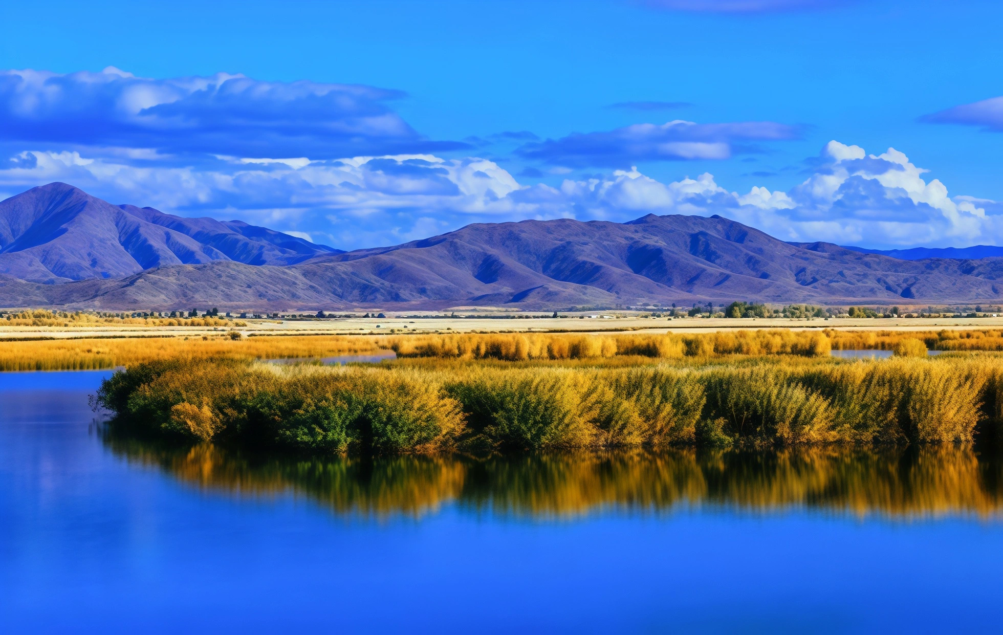
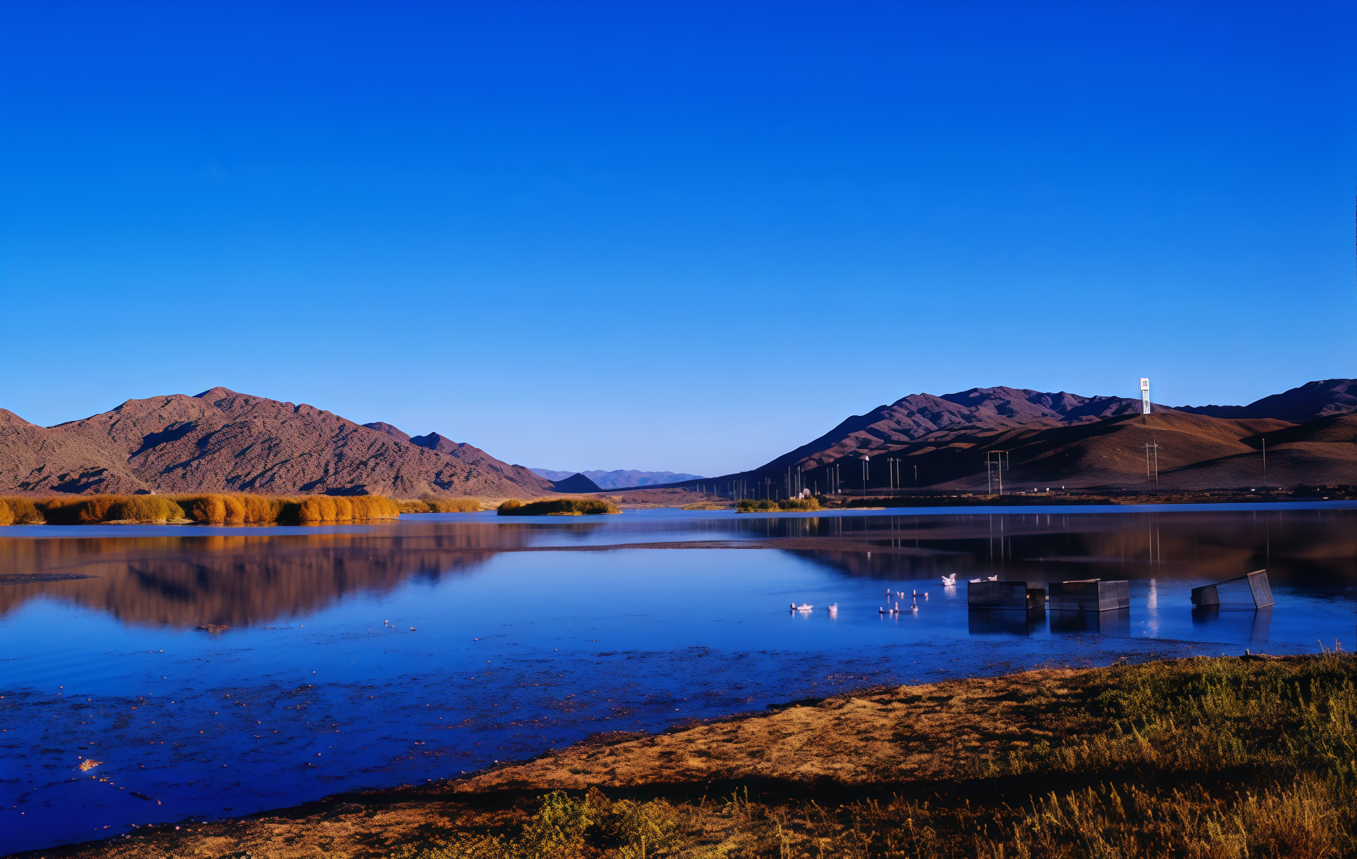
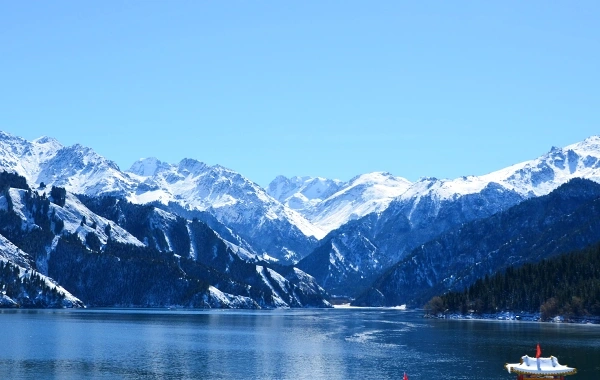
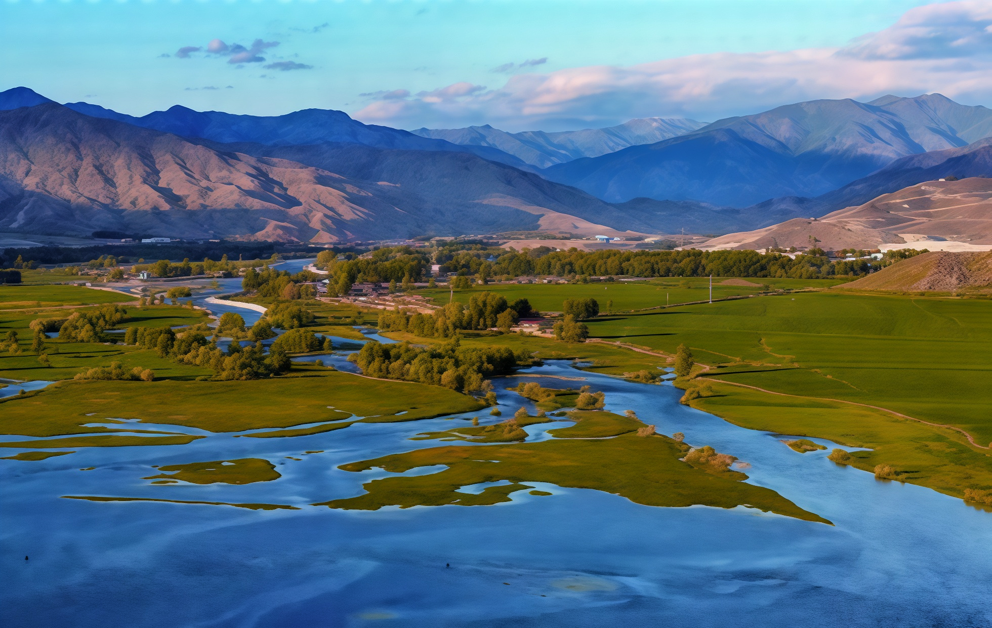
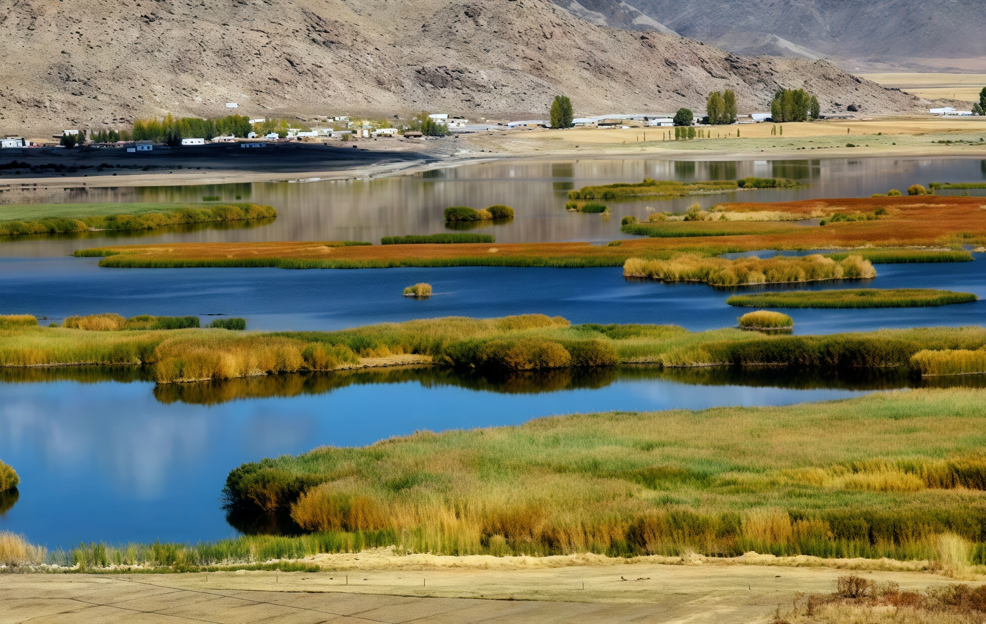
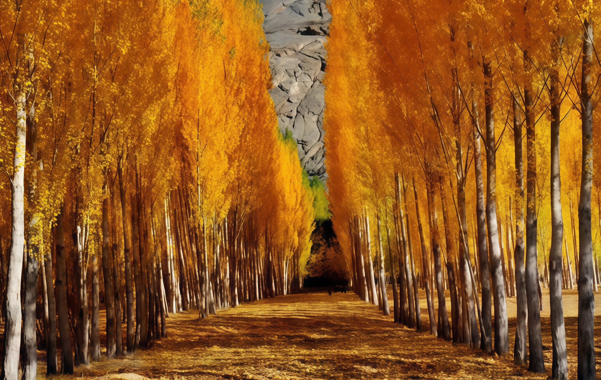
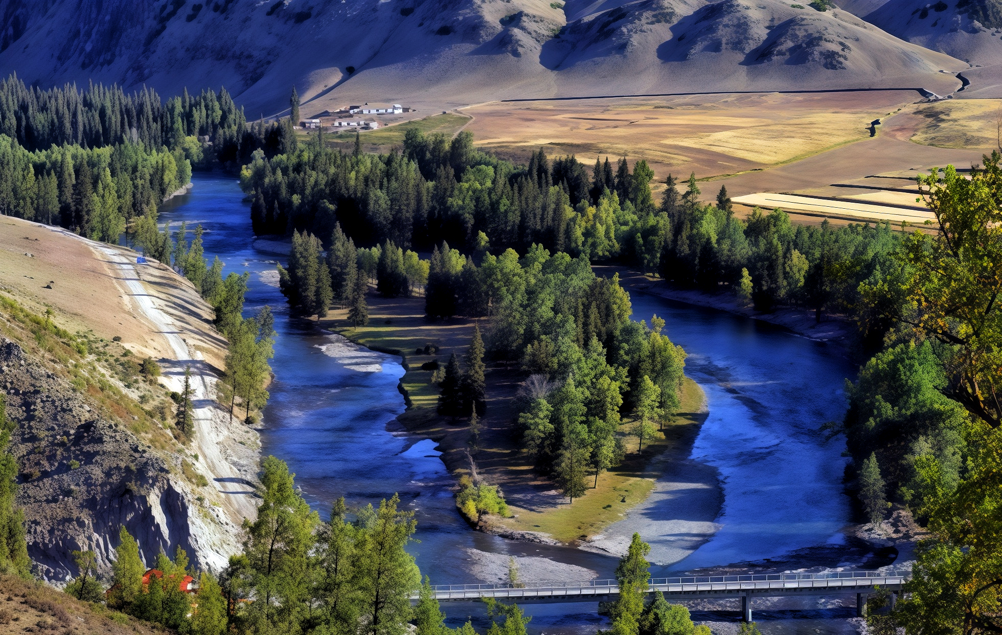
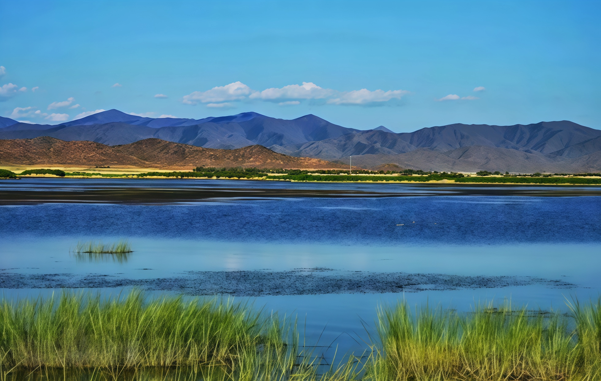
- The Irtysh River: This is the lifeblood and soul of Koktokay. As my country’s only exorheic river—one that flows outward—it travels from east to west to empty into the Arctic Ocean. The river spans a total length of 2,969 kilometers, with 546 kilometers running within Chinese territory. In the Koktokay section, the water gleams a jade-like blue; winding through golden canyons, it harmonizes in autumn with the golden hues of the birch forests lining its banks, creating a breathtaking tableau known as "Blue Waters, Golden Shores."
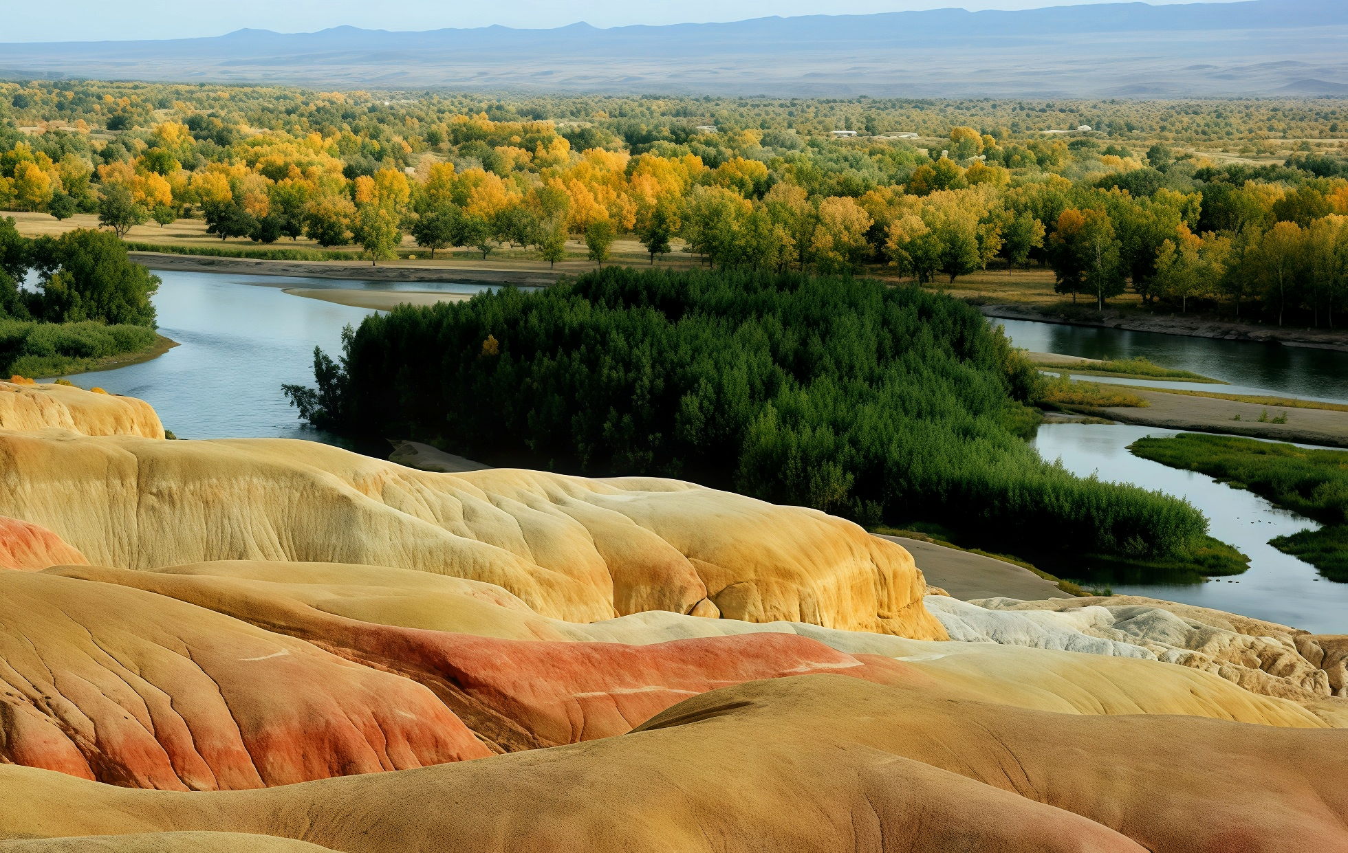
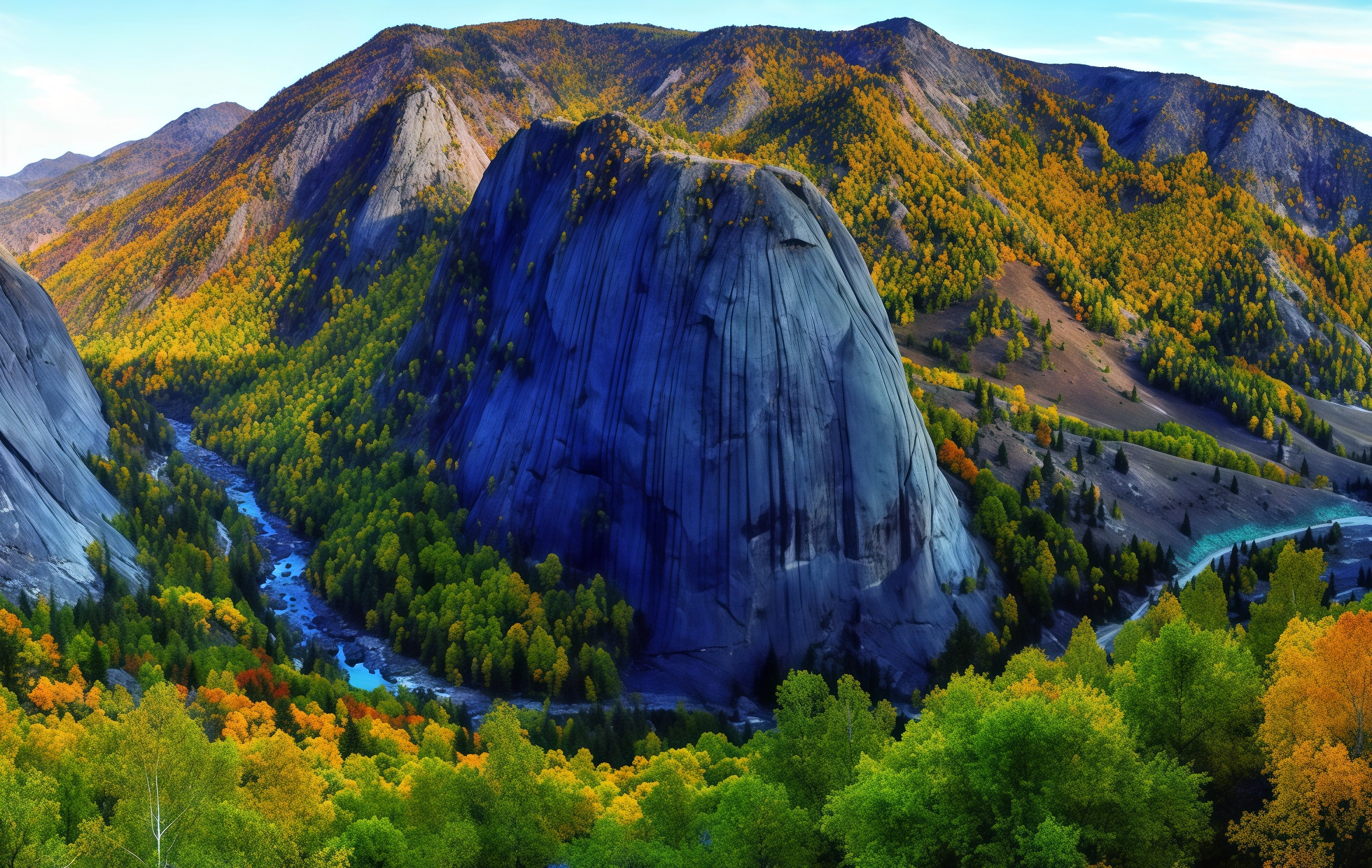
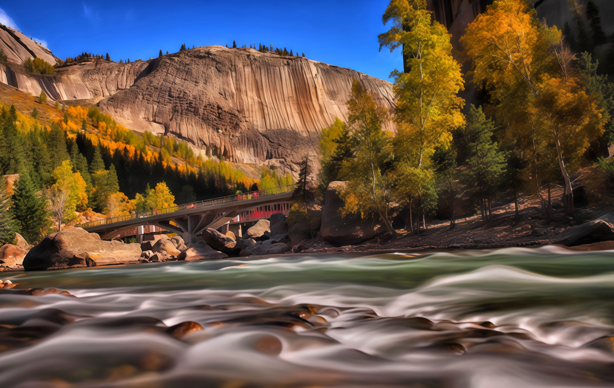
- The Irtysh Grand Canyon: Extending along the river, the canyon forms a distinct "U" shape, stretching approximately 8 kilometers in length with a floor width ranging from 10 to 40 meters. As you traverse the canyon, the river flows—at times rushing and turbulent, at others tranquil and gentle—perfectly complementing the bizarre peaks and strangely shaped rocks that flank its banks. Photography Tip: On sunny days, shoot before 10:00 AM with the light at your back (front lighting) to capture the river water at its most vivid shade of blue.
- Jilande Hot Springs: Meaning "Hot Spring" in Mongolian, this natural therapeutic spring sees water naturally seeping from fissures in the granite bedrock. With its pleasant temperature and clear, silky-smooth water, it has long been a cherished site; local Kazakh herdsmen maintain a tradition of visiting the springs to bathe during festive occasions. Scattered near the main springs are three mystical subsidiary springs—the "Stomach Spring," the "Blood Pressure Spring," and the "Satiety Spring"—each reputed to possess its own unique healing properties.
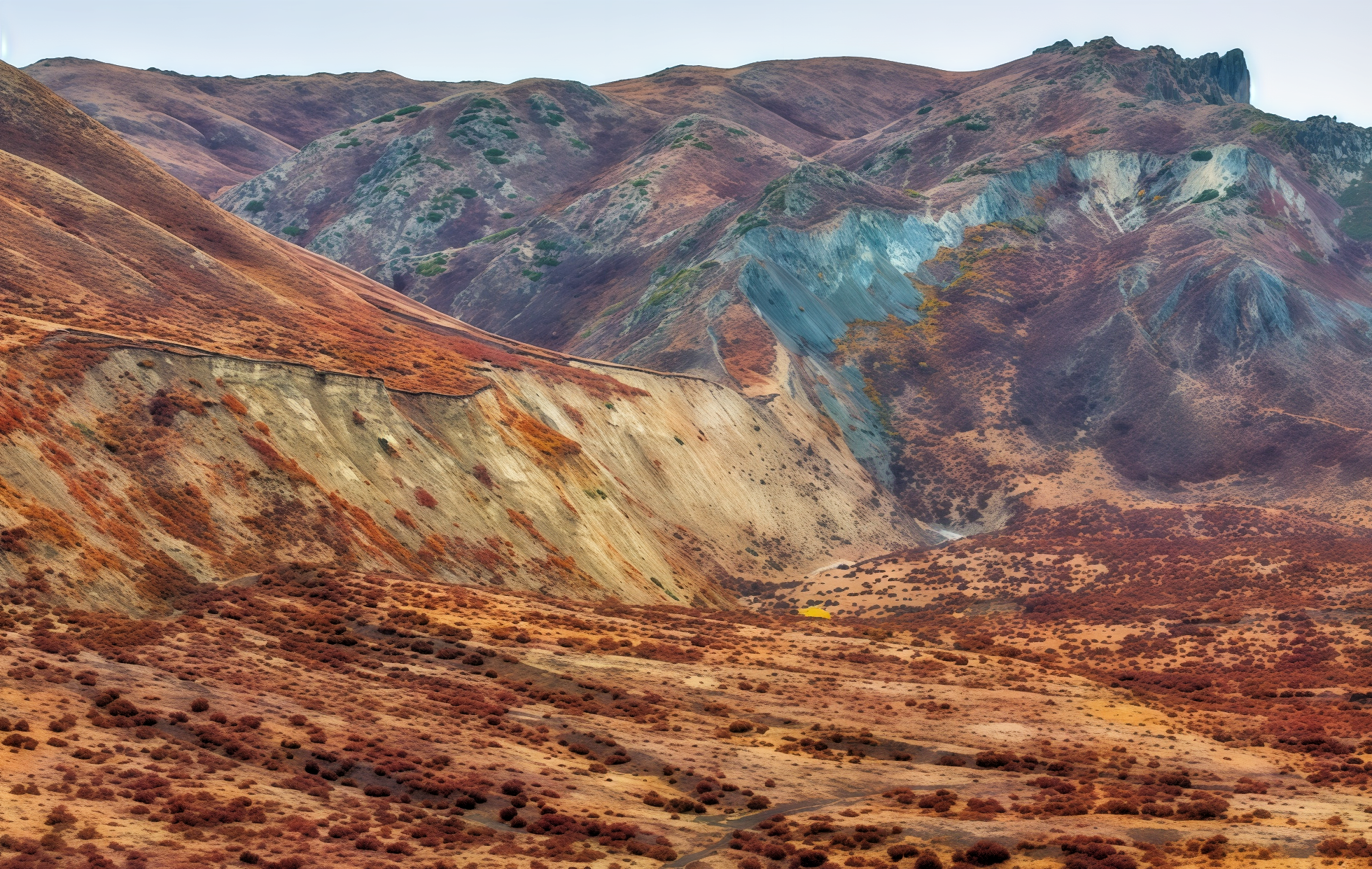
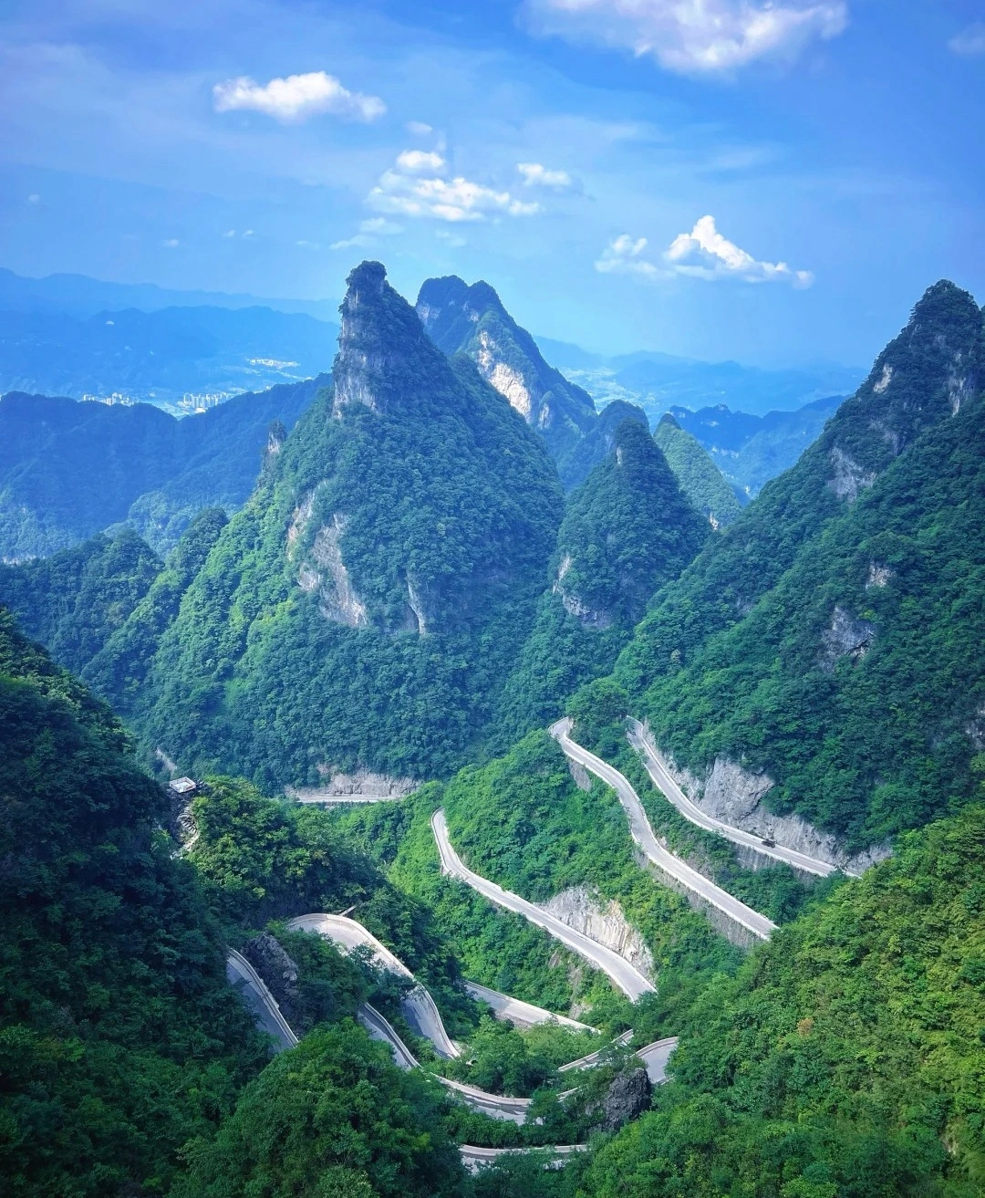
The Rugged Rocks: A Fantastical Theater of 108 Granite Peaks
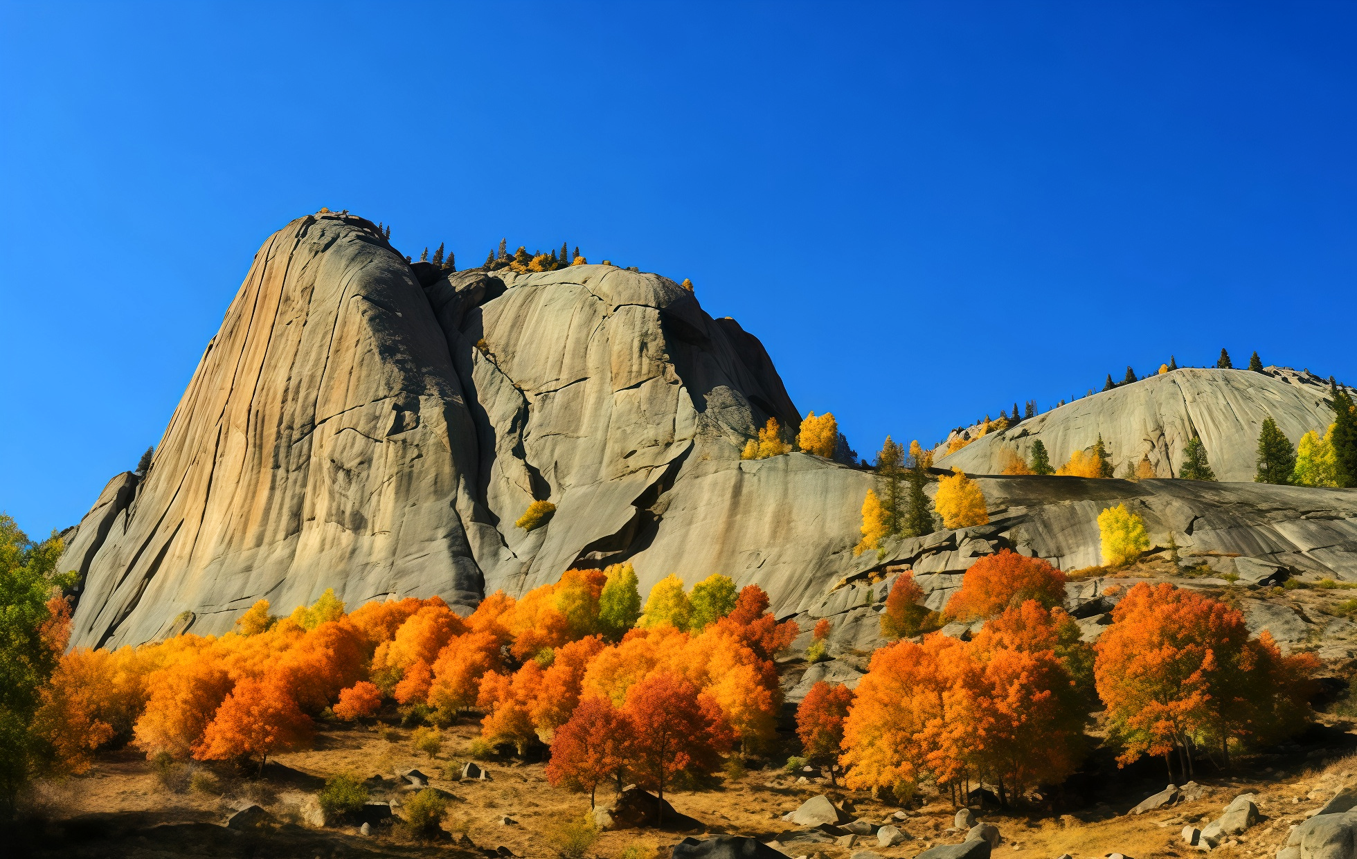
Lining the Irtysh River, the granite peaks of the canyon rise in opposing, continuous formations. With their rounded contours and diverse shapes, they are collectively celebrated as the "One Hundred and Eight Peaks." These majestic formations date back to the Yanshanian Orogeny (approximately 208 to 65 million years ago) and were sculpted over millennia by the forces of frost weathering and erosion.
- Shenzhong Mountain (Amirsala Peak): The spiritual landmark and iconic symbol of Koktokay. Rising abruptly from the flat terrain on the southern bank of the Irtysh River stands this miraculous granite monolith—a bizarre and magnificent peak shaped like an inverted stone bell. With a relative height of 351 meters, this solitary spire stands in proud isolation, reigning as the most prominent and commanding peak in the entire Altai Mountain range. Birch trees, green pines, and Siberian spruces cling to the crevices of the rock faces; when the rain clears and a rainbow arcs across the sky, the scenery becomes truly spectacular. Photography Tip: Looking back from the waterfall ravine, you can capture the classic shot featuring the "Divine Bell Mountain" framed alongside the golden larches.
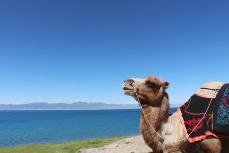
- The Cluster of Figurative Rocks: As you stroll along the stream, it feels as though you have stepped into a natural museum of geological curiosities. Rocks bearing whimsical resemblances—such as Camel Peak, Elephant Peak, Eagle Peak, the "Flying-in" Peak, the Wealth Turtle, the Centaur, the Seal, and the Stone Gate—abound; each peak seems to be narrating a beautiful story of its own.
- Intricate Textures: The surfaces of the granite peaks are covered in dense, honeycomb-like pits and vertical grooves—imprints left behind by frost weathering and water erosion. Resembling a colossal, frozen waterfall, these formations silently chronicle millions of years of geological transformation.
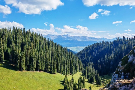
The Forest of Hidden Realms: A "Breathing" Gallery of Color
The canyon boasts a high forest coverage rate, dominated by firs, pines, birches, and poplars, which harmonize perfectly with the cascading rocks and rushing currents of the Irtysh River.
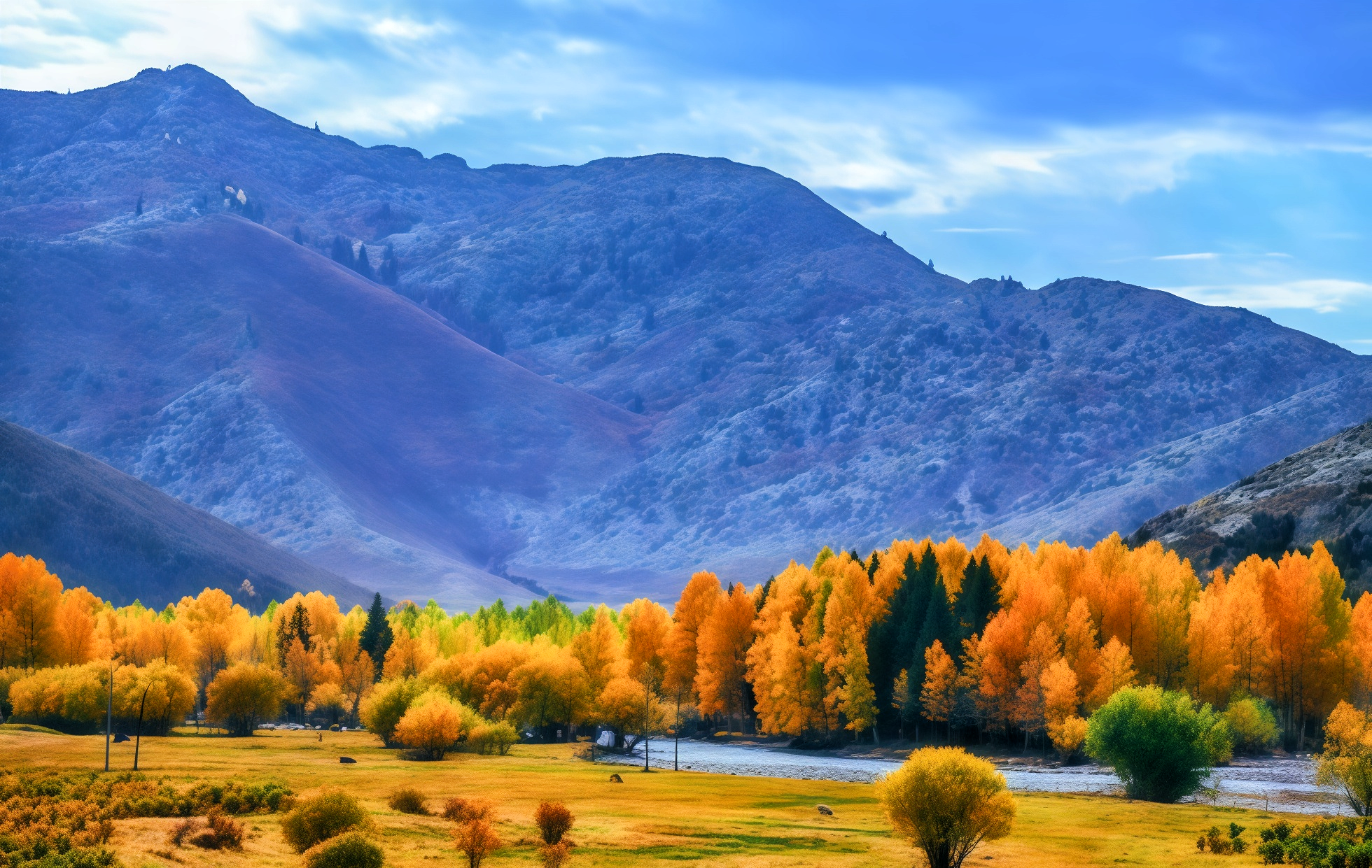
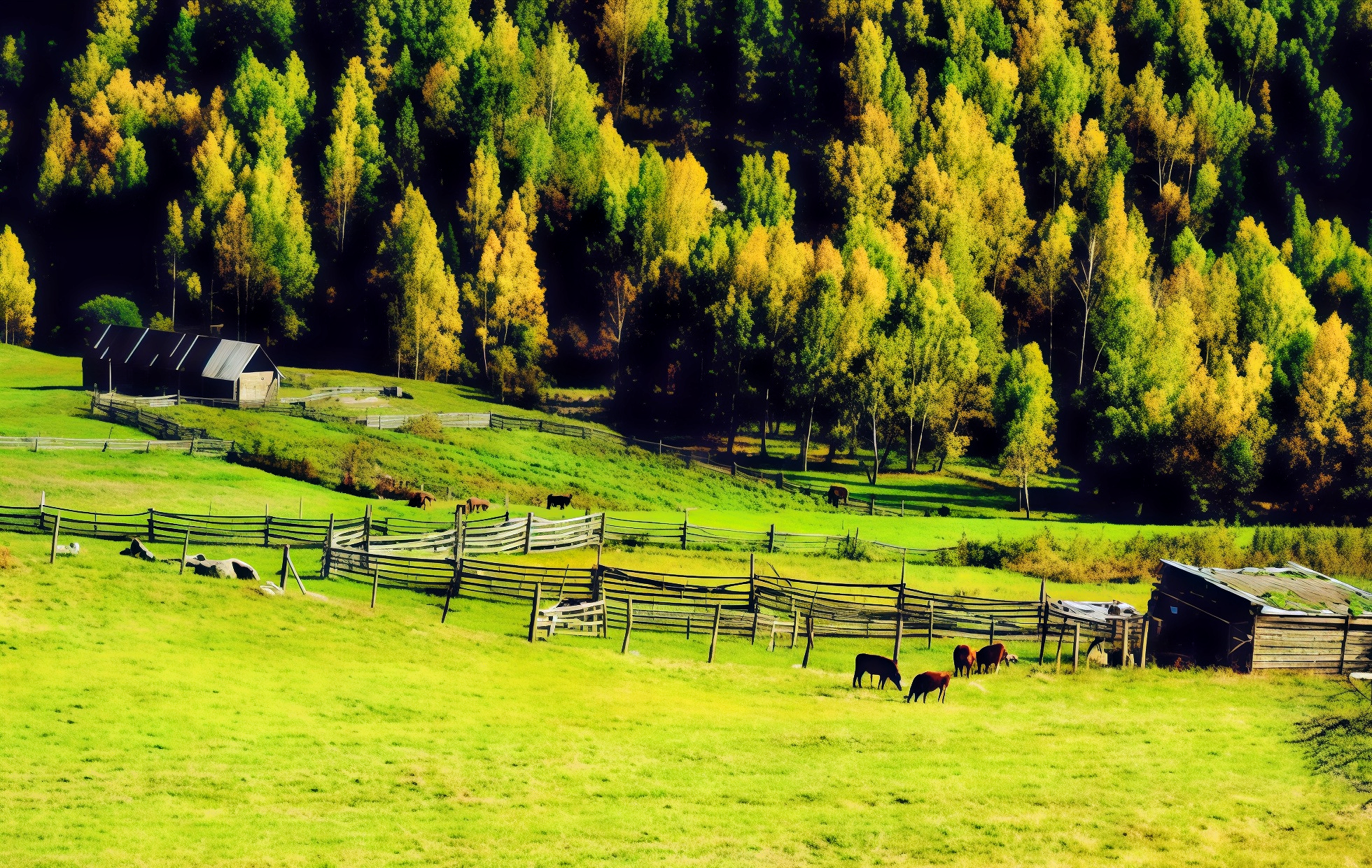
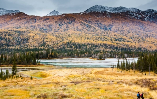
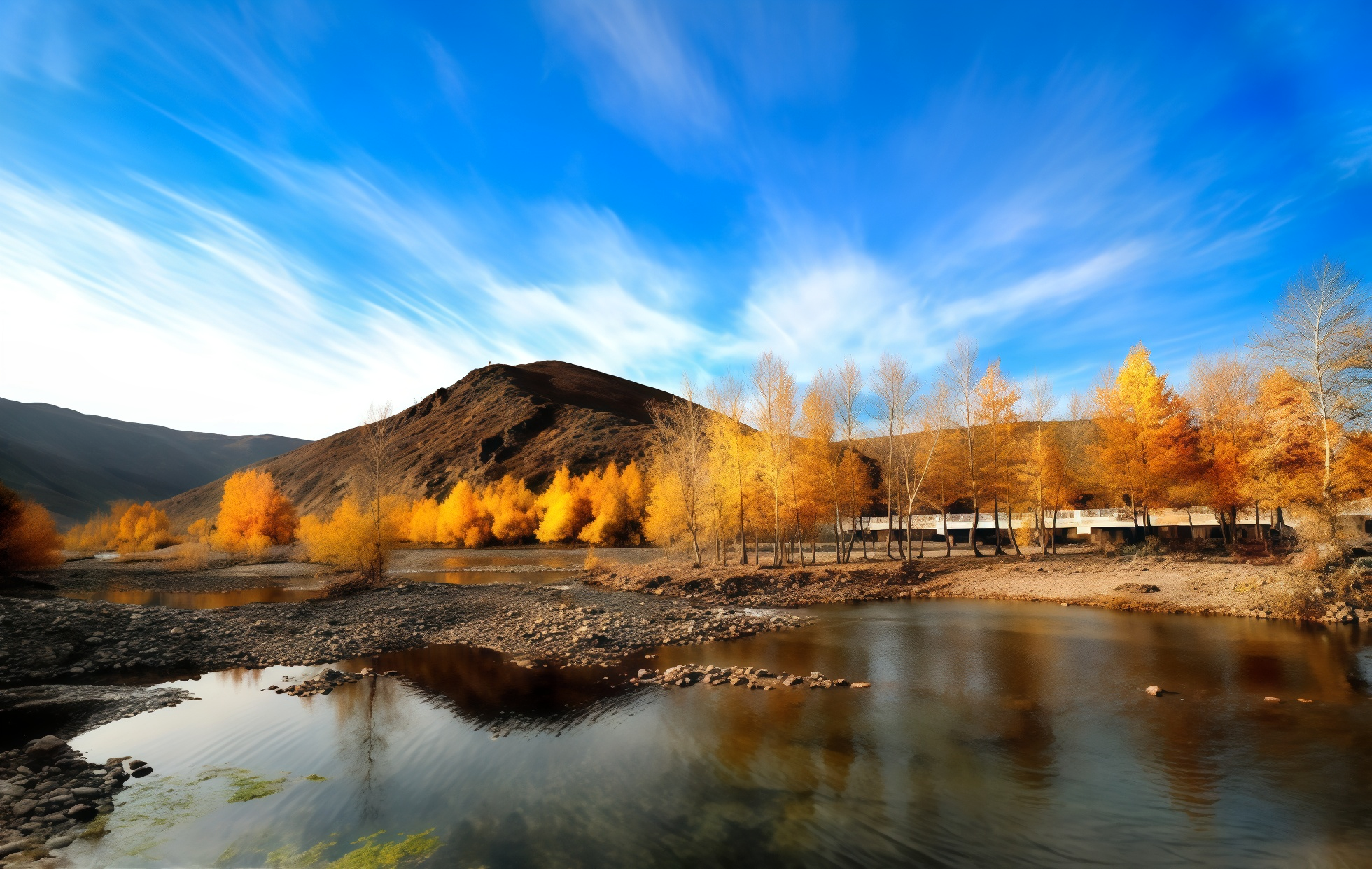
- The Birch Forest: In the autumn, the birch trees are the first to turn golden; their silvery-white trunks create a striking contrast against their brilliant yellow foliage. As sunlight filters through the leaves, casting dappled patterns of light and shadow, the forest becomes a true paradise for photography enthusiasts.
- The "Couple Trees": Located within Gemstone Ravine, these two ancient trees—a pine and a birch—grow side-by-side in a close embrace. Symbolizing steadfast and undying love, they have become a popular pilgrimage site for couples.
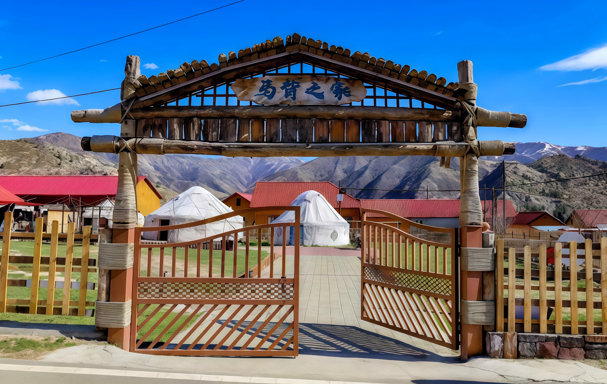
- The Seasonal Migration Route: From late September to early October, Kazakh nomads drive their herds of cattle and sheep southward from their summer pastures. This magnificent procession of migrating livestock winds its way through the "Golden Canyon," creating a scene of poetic beauty—a unique cultural landscape found only in Koktokay.
The natural wonders of Koktokay offer an experience that goes far beyond mere "sightseeing"; it is about "listening" to the rushing currents of the Irtysh River, "feeling" the rugged grandeur of the granite peaks, and "immersing" oneself in the vibrant feast of colors that defines the golden autumn season.
Monuments of Humanity—Meritorious Ore Veins and "Red" Memories
Here, one finds not only the awe-inspiring artistry of nature but also a history of human struggle etched into the very rock.
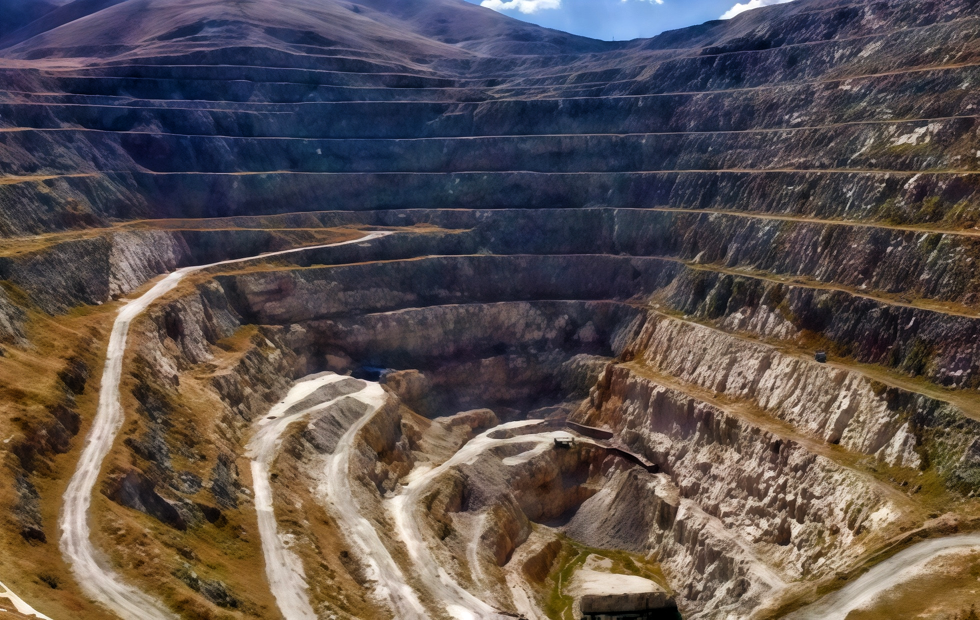
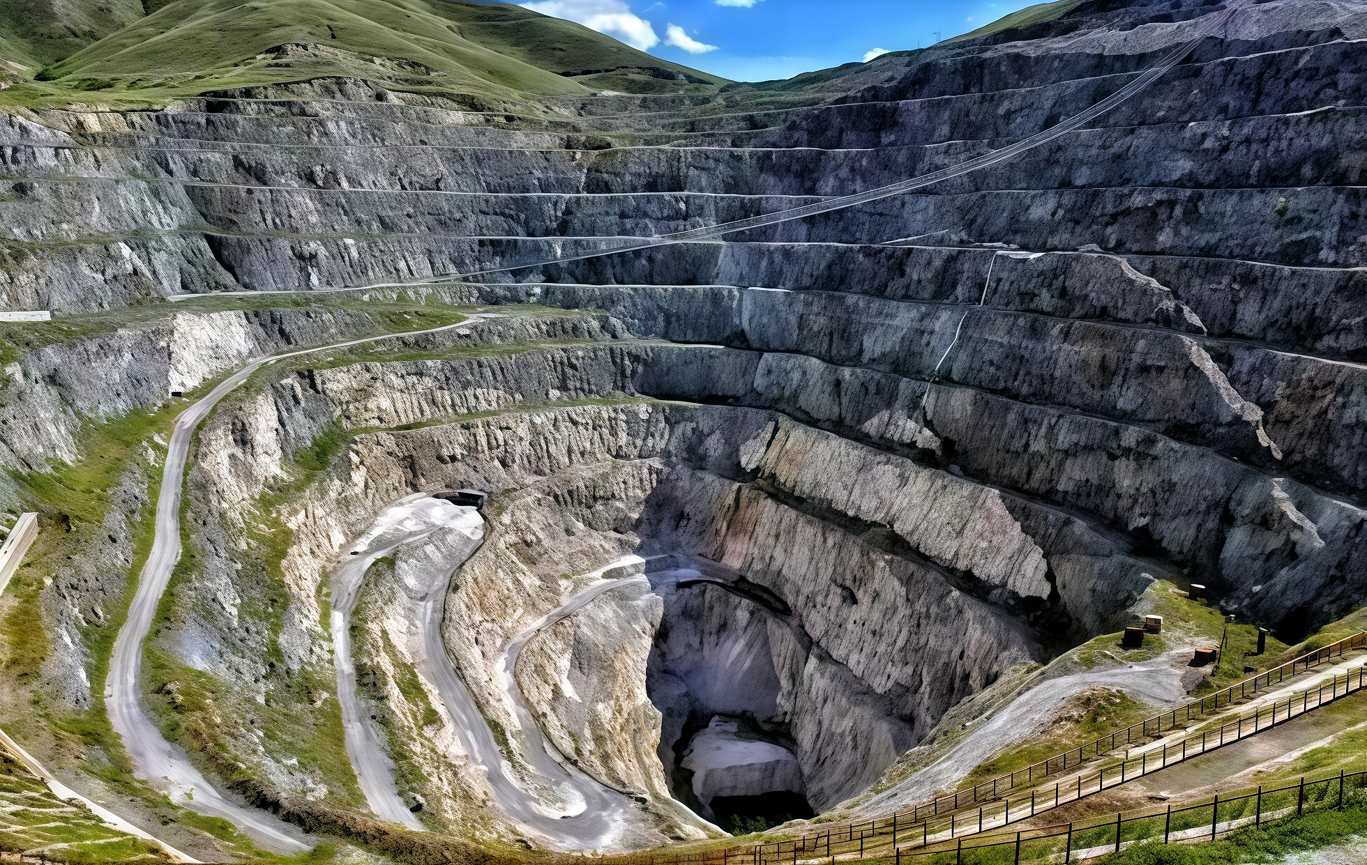
Ore Vein No. 3: The Republic’s Meritorious Mine
This stands as the most breathtaking cultural landmark in Koktokay. The open-pit mine—spanning a diameter of 500 meters—resembles a colossal vortex embedded within the mountain range; plunging to a depth of 350 meters at its deepest point, it delivers a powerful visual impact. The site is a treasure trove of rare metals; it contains all eight rare elements listed in China’s Specifications for Geological Exploration of Rare Metal Mineral Deposits and boasts a cumulative total of 80 identified mineral species—26 of which are rare metal minerals—earning it the title of a "Natural Museum of Rare Metal Minerals." Standing at the rim of the pit and gazing down, one can almost hear the roar of the mining machinery from days gone by and sense the palpable passion of those fiery years.
The Ayigozi Mine Tunnel: A Tunnel Through Time
Located 500 meters south of Ore Vein No. 3 lies the Ayigozi Mine Tunnel. In the past, miners utilized hammers, steel chisels, pickaxes, shovels, and small-scale machinery to conduct underground mining operations on the ore vein, carving out a tunnel-like passage approximately 800 meters in length. While the warm sun shines brightly outside, the interior of the tunnel is piercingly cold, with winter temperatures plummeting to between -30°C and -40°C. The marks left by rock-chiseling tools and the distinct layers of the ore vein remain clearly visible on the tunnel walls, seemingly whispering tales of the hardships and resilience of the miners who worked there. Guided tours are available throughout the route, recounting the heroic era defined by the motto: "We may endure hardship ourselves, but we must never let the nation suffer."
The Geological Exhibition Hall: A Treasury of Irtyshite
Constructed in 1957, this Russian-style building originally served as the Workers' Club for the Koktokay mining district; today, it stands as the best-preserved example of Russian-style architecture in all of Xinjiang. The hall houses a collection of over 400 geological specimens and exhibits, encompassing a diverse array of 94 distinct mineral species. Among its holdings are two world-class mineral specimens and three national-class specimens; the only known sample of "Ertixite"—ever discovered in the world to date—is also carefully preserved within the museum. This stone, no larger than a fingernail, consists of 80% sodium silicate; the remaining 20% contains trace elements not found in the periodic table, giving it a research value far exceeding that of diamonds and other gemstones.
Keketuohai Hydropower Station: A Vigil 136 Meters Underground
Constructed 136 meters beneath the earth's surface, this hydropower station stands as a miracle in the history of hydroelectric engineering in New China. Construction began in 1958 and was largely completed by the end of 1966; for reasons of national defense and confidentiality, the site was deliberately chosen deep within the mountains. It takes a 2-minute and 20-second elevator ride down to reach the actual power generation hall. Faded slogans, penned by the workers of that era, remain preserved on the mottled walls: "Be Resolute, Fear No Sacrifice, and Surmount Every Difficulty to Win Victory." The hydropower station has operated safely for over half a century, yet more than 50 young lives were forever claimed by these mountains; their spirit of unwavering dedication continues to inspire future generations to this day.
> Photography Tips:
- The best vantage point for panoramic shots is the observation deck located directly across from Shenzhong Mountain (God's Bell Mountain); from here, you can capture Shenzhong Mountain, the Ertix River, and the "Golden Forest" all in a single frame.
- The optimal time to photograph Pit No. 3 is at dusk, when the mine walls glow with warm red hues, creating a striking contrast against the blue sky.
- For the White Birch Forest, it is recommended to shoot before 10:00 AM, when the sunlight strikes at a low angle, casting dappled shadows through the trees.
- Drone flight is permitted, allowing you to capture epic, "God's-eye-view" perspectives of the winding canyon and the towering forest of peaks.